![](/images/other/stat-length.png)
![Trail Mountain bike La Talaudière - La 22ème Talaudièroise (VTT-2011) - La Talaudière - Photo](https://media.geolcdn.com/t/1900/400/ext.pjpeg?maxdim=2&url=https%3A%2F%2Fservices.sitytrail.com%2FGeolivesWS%2FDownloadMedia.ashx%3FTrailID%3D106656%26Media%3D11275_6.jpg)
La 22ème Talaudièroise (VTT-2011) - La Talaudière
tracegps
User
![Length](/images/other/stat-length.png)
![Max alt](https://static1.geolcdn.com/siteimages/upload/files/1508320355ic_sort_altitude_max_24dp.png)
![Uphill gradient](https://static1.geolcdn.com/siteimages/upload/files/1508320355ic_sort_den_pos_24dp.png)
![Km-Effort](/images/other/stat-length.png)
![Min alt](https://static1.geolcdn.com/siteimages/upload/files/1508320355ic_sort_altitude_min_24dp.png)
![Downhill gradient](https://static1.geolcdn.com/siteimages/upload/files/1508320355ic_sort_den_neg_24dp.png)
![Boucle](https://static1.geolcdn.com/siteimages/upload/files/16400158638029165_repeat_loop_refresh_sync_direction_icon.png)
![Mountain bike](https://static1.geolcdn.com/sitytour/trail-icons/202.png)
5h00
Difficulty : Very difficult
![Scan this QR Code to open this trail in the SityTrail application](https://capi.geolives.com/qq0zvz2zws4bq2lad0pu/sitytour/trails/106656/qr.png?size=200)
FREE GPS app for hiking
About
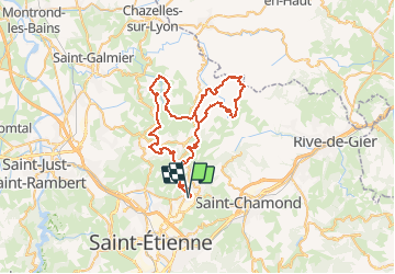
Trail Mountain bike of 63 km to be discovered at Auvergne-Rhône-Alpes, Loire, La Talaudière. This trail is proposed by tracegps.
Description
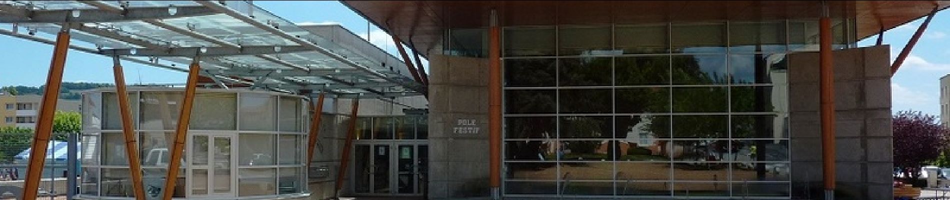
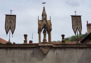
Parking et Départ du Pôle Festif à la Talaudière. Cette randonnée organisée par le club "Cyclos Talaudière-Sorbiers" (CTS) s'est déroulée le samedi 28 mai 2011. Tout proche de Saint-Etienne, La Talaudièroise est un gros rendez-vous, très bien organisé, avec un parcours de 65 km tracé dans les Monts du Lyonnais. Cette boucle est exclusivement réservée aux VTTistes confirmés et bien entraînés qui aiment le vrai VTT avec des ascensions ardues (voire très techniques) et des descentes rapides et parfois caillouteuses. Il y a des portions roulantes (sur la route) qui permettent de récupérer ou de faire monter la moyenne, c'est vous qui voyez !!! Tout passe sur le VTT si les cuissots et les mollets sont bien affûtés (gare aux pertes de motricité de la roue arrière). Les paysages sont absolument splendides : vues sur le bassin Stéphanois, les massifs du Pilat, du Forez et les Monts du Lyonnais. Topoguides : VTT - Entre Forez et Jarez ; Découvrir Sorbiers et sa campagne ; Promenades ou randonnées sur les sentiers de la Tour-en-Jarez au Nord de Saint-Etienne.
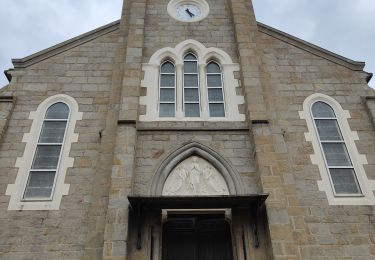
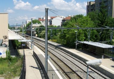
Positioning
Comments
Trails nearby
![Trail Walking Sorbiers - Randonnée au dessus de Sorbiers - Photo](https://media.geolcdn.com/t/375/260/a6bbe919-adb1-45cb-b135-8681461c4bcc.jpg&format=jpg&maxdim=2)
![Walking Walking](https://static1.geolcdn.com/sitytour/trail-icons/101.png)
Walking
![](/images/other/stat-length.png)
![](https://static1.geolcdn.com/siteimages/upload/files/16400158638029165_repeat_loop_refresh_sync_direction_icon.png)
![Trail On foot Saint-Étienne - Voie Verte Terrasse-Bellevue - Photo](https://media.geolcdn.com/t/375/260/96d4883c-d9c8-402a-9eb6-5267c2e74d6f.jpeg&format=jpg&maxdim=2)
![On foot On foot](https://static1.geolcdn.com/sitytour/trail-icons/100.png)
On foot
![](/images/other/stat-length.png)
![](https://static1.geolcdn.com/siteimages/upload/files/16400158638029165_repeat_loop_refresh_sync_direction_icon.png)
![Trail Walking Sorbiers - sorbier Gondran - Photo](https://media.geolcdn.com/t/375/260/ext.jpg?maxdim=2&url=https%3A%2F%2Fstatic1.geolcdn.com%2Fsiteimages%2Fupload%2Ffiles%2F1553511878bg_sport_marche.png)
![Walking Walking](https://static1.geolcdn.com/sitytour/trail-icons/101.png)
Walking
![](/images/other/stat-length.png)
![](https://static1.geolcdn.com/siteimages/upload/files/16400158638029165_repeat_loop_refresh_sync_direction_icon.png)
![Trail Cycle Saint-Chamond - samedi 13 août 22 - Photo](https://media.geolcdn.com/t/375/260/ext.jpg?maxdim=2&url=https%3A%2F%2Fstatic1.geolcdn.com%2Fsiteimages%2Fupload%2Ffiles%2F1524743154velo.jpg)
![Cycle Cycle](https://static1.geolcdn.com/sitytour/trail-icons/200.png)
Cycle
![](/images/other/stat-length.png)
![](https://static1.geolcdn.com/siteimages/upload/files/16400158638029165_repeat_loop_refresh_sync_direction_icon.png)
![Trail Walking Valfleury - Valfleury - Découverte de ce petit Lourdes et de ses environs - Photo](https://media.geolcdn.com/t/375/260/16f0dea3-73b6-45fe-b6f5-0da3d54ae22a.jpg&format=jpg&maxdim=2)
![Walking Walking](https://static1.geolcdn.com/sitytour/trail-icons/101.png)
Walking
![](/images/other/stat-length.png)
![](https://static1.geolcdn.com/siteimages/upload/files/16400158638029165_repeat_loop_refresh_sync_direction_icon.png)
![Trail Walking La Valla-en-Gier - Le Chirat Le Bâcha. Rosillol La Rivoire. - Photo](https://media.geolcdn.com/t/375/260/5b15e76a-0174-4fc8-8ce1-14b387fdd206.jpg&format=jpg&maxdim=2)
![Walking Walking](https://static1.geolcdn.com/sitytour/trail-icons/101.png)
Walking
![](/images/other/stat-length.png)
![](https://static1.geolcdn.com/siteimages/upload/files/16400158638029165_repeat_loop_refresh_sync_direction_icon.png)
![Trail Walking Saint-Étienne - Le tour du bois D'aveze - Photo](https://media.geolcdn.com/t/375/260/76307f56-cc46-4756-817b-5159e9dca1d2.jpg&format=jpg&maxdim=2)
![Walking Walking](https://static1.geolcdn.com/sitytour/trail-icons/101.png)
Walking
![](/images/other/stat-length.png)
![](https://static1.geolcdn.com/siteimages/upload/files/16400158638029165_repeat_loop_refresh_sync_direction_icon.png)
![Trail Walking Sorbiers - sorbiers 23/2 - Photo](https://media.geolcdn.com/t/375/260/ext.jpg?maxdim=2&url=https%3A%2F%2Fstatic1.geolcdn.com%2Fsiteimages%2Fupload%2Ffiles%2F1553511878bg_sport_marche.png)
![Walking Walking](https://static1.geolcdn.com/sitytour/trail-icons/101.png)
Walking
![](/images/other/stat-length.png)
![](https://static1.geolcdn.com/siteimages/upload/files/16400158638029165_repeat_loop_refresh_sync_direction_icon.png)
![Trail Walking Sorbiers - sorbiers - Photo](https://media.geolcdn.com/t/375/260/ext.jpg?maxdim=2&url=https%3A%2F%2Fstatic1.geolcdn.com%2Fsiteimages%2Fupload%2Ffiles%2F1553511878bg_sport_marche.png)
![Walking Walking](https://static1.geolcdn.com/sitytour/trail-icons/101.png)
Walking
![](/images/other/stat-length.png)
![](https://static1.geolcdn.com/siteimages/upload/files/16400158638029165_repeat_loop_refresh_sync_direction_icon.png)